In June, we stayed for 7 days in the small town of Tilcara, in the remote northwest of Jujuy (pronounced “hoo-hwee”), Argentina. From here, it’s about a 2 hour drive to Salinas Grandes, Argentina’s largest salt flats. It’s in the Puna (aka Antiplano), which is a windswept plateau in the Andes, and the Puna in the province of Jujuy is the second-highest plateau on earth (the first is in Tibet).
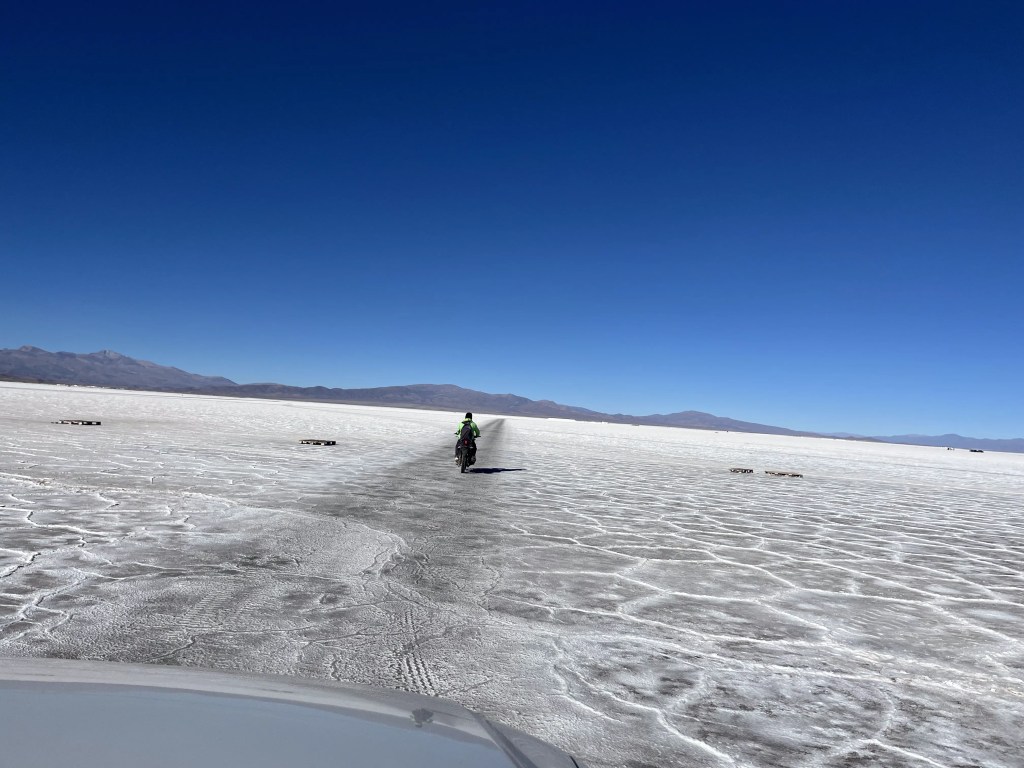
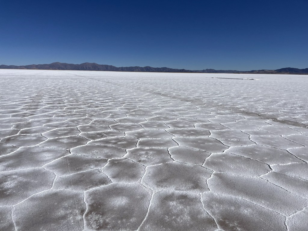
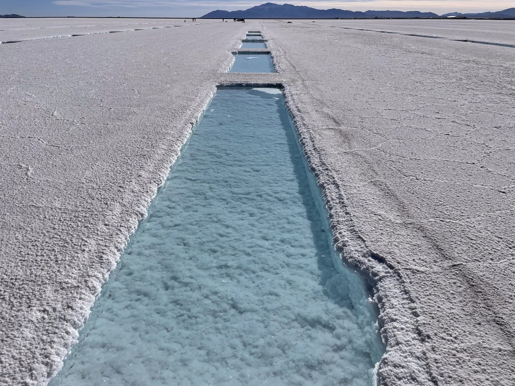
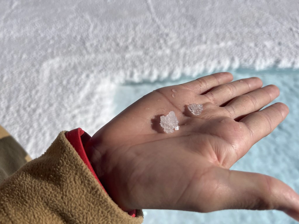
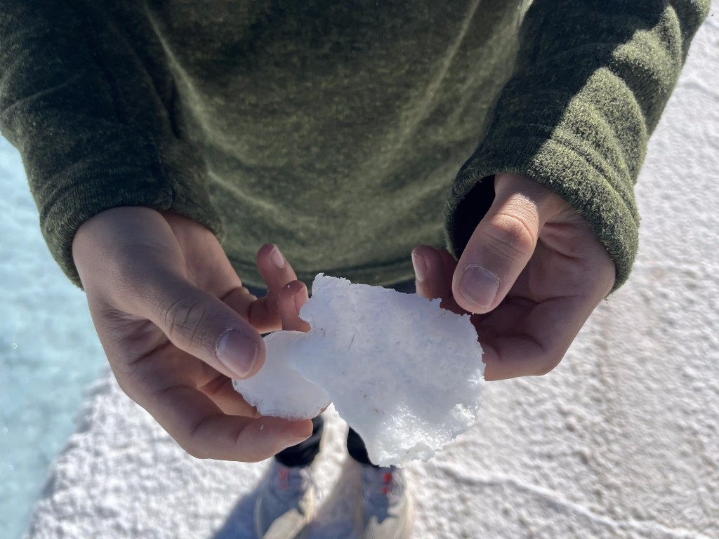
We pass by the village of Purmamarca where we can see the Cerro de los Siete Colores (Hill of Seven Colours). The colours are due to the minerals and sediments formed over millions of years underwater, which are now being exposed. Starting with the oldest at over 500 million years, there’s green from copper oxide, white from calcium carbonate, yellow from sulfur, reddish from iron, and brown from manganese, which is the youngest at about a million years. The road begins to climb up the hills.Not too scary passing one of these on a wide, well-paved road.After Purmamarca, we join with Route 52, the super sinuous highway to Salinas Grandes. Route 52 was one of the best roads we travelled in Argentina – paved and smooth, winding our way up Cuesta de Lipan.Route 52 peaks at 4,170 m, through the Altos del Morado pass. Fortunately, no one had issues with altitude sickness.Burned out husks of cars, Llama, alpaca, vicuña, or guanaco? All camelids, like the camel and dromedary!At the Abra de Potrerillos lookout, we catch a glimpse of the salt flats – the white in the distance over on the left.The view while approaching the Salinas Grandes. It’s just over 212 square kilometres and almost 3,500 m above sea level. You need a guide to enter the flats as it’s a major tourist destination as well as an active salt mining site. Our guide, Blas, said that the flats are about 5-10 million years old, and is a result of volcanic eruptions when the tectonic plates collided, creating the mountain ranges around this basin.It looks like small dusting of snow, except for the hexagonal and pentagonal patterns as far as you can see.These polygonal shapes appear throughout all the salt flats across the world, and is thought to be due to fluid convection during evaporation.Hexagonal and pentagonal shapes seen from Nolan’s drone.Blas explained that these pools were cut by an excavator and are 2m x 8m x 9m, and 60cm 90cm deep. Then they wait for the groundwater to seep in, then wait some more for the water to evaporate, before harvesting the salt. The salt floating on the water in this photo is what they call a ‘salt flower’. It started as a flake that grew until it’s large and heavy enough to settle to the bottom of the pool. The evaporation takes about 1.5-2 years (yes, years), and 6 to 9 tons of salt can be harvested from each pool. The salt is shovelled into a pile by the excavator beside the pool to dry for a day or two before being packed into 50 kg bags. This first type of salt extraction yields the finest quality of salt, suitable for human consumption. The second quality of salt is scraped from the surface of the salt flat after the rain falls between December to March. This salt is used in industry for leather tanning, leaf bleaching and cleaning. The third quality of salt is extracted from the edges of the salt flat, where the thickness of the salt is 12 to 20 cm, unlike the center, which is 1.5 meters deep. This salt is used for animal consumption. [This photo doesn’t show the edge of the salt flat, we just thought the bulldozer scraping and piling salt was cool.]Salt crystalsLooks like a chunk of snow
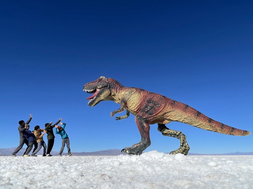
Blas brought a couple of props to take some forced perspective photos by the pools.
Course the kids got in there and had some fun too!
Photo by Nolan.Photo by Nolan.
In addition to sodium and potassium, the salt brines in the flats are a source of lithium. In lithium mining, the underground aquifers are pumped to be evaporated, leaving concentrated brine. Using chemicals, lithium is precipitated out of the concentrated brine, then the residue is filtered and dried. Argentina, Chile and Bolivia comprise the “lithium triangle”, containing over 75% of the world’s supply of lithium.
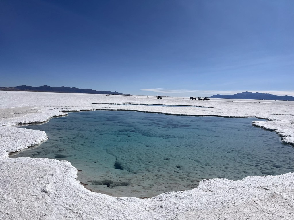
Lithium mining is controversial as it negatively affects groundwater levels, causing drought and water shortages in this already arid environment. This then impacts the traditional agricultural way of life. The indigenous communities have united to prevent the water from being pumped out of the salt flats to access the lithium. This sign says “We reject the tenders for the 11 thousand hectares of lithium in the Salinas Grandes basin and Laguna Guayatayoc.”Blas indicated that there is currently no active lithium mining at Salinas Grandes. This sign says “Respect our territory, lithium company out”.Our rental (gas powered) and Blas’ motorbike.Next stop was the Ojos del Salar, pools of groundwater in Salinas Grandes. They’re 2-3 m deep, contain minerals such as copper, iron, and sulfur, and were very clear. Here, we had to follow specific paths and not touch the water to avoid contaminating or destroying the area.


Very interesting!!